2003 07 27 Pyramid Lake, Smoke Creek, Black Rock
2003 07 28 Truckee to Elko NV, Tuscarora
2003 07 29 Elko NV to Mountain Home ID, Bruneau Dunes
2003 07 31 Bruneau Dunes, ID, Sun Valley, ID
2003 08 01 Mountain Home ID to Ely NV
2003 08 04 Ely to Fallon NV, Eberhart, Dixie Valley
2003 07 27 Pyramid Lake, Smoke Creek, Black Rock
Today I made a long day trip, out to Reno, up around Pyramid Lake (west side) then into the Smoke Creek and Black Rock deserts. It was hot.
I have been into this area many times but it is one of my favorites. I knew the Black Rock playa would be dry enough to drive on so I made a point of going that far in spite of the heat.
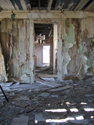
On the way there I stopped and took some pictures at the abandoned Bonham Ranch. It's slowly coming apart, and I have been there enough times now that I can see the differences:
 |
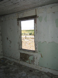 |
In the second picture you can see the Smoke Creek Desert going off into the distance. It goes a long way ..
While driving up the west side of Smoke Creek I took a small detour west towards California. There is a nice little spot called "Robber's Roost" along this road. Cool and shady and there is even water in the Smoke Creek:
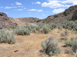 |
This is part of the California Trail, and I understand this part. (Compared to the next.) There's actually shade and water! The sage smell was so intense here that I think you could have made a nice sage roast chicken just by laying it out on a flat rock.
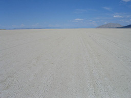
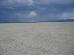
After this I drove up to and out on the Black Rock playa. This is a weird experience. It is so big and so flat that you don't feel as if you are moving even if you're going 60 MPH.. It was hot .. and the new book of maps I have reminded me that this desert was part of the California trail, bringing wagon trains of people into California. I can't imagine what this was like on foot, with wagons and dumb animals plodding along. Miserable. You'd have to be very motivated or very foolish to do this. Maybe both. I wanted to stay out on the playa longer, but it was early and hot, and it looked like a very large thunderstorm was coming up from the south. I did not want to take a chance getting stuck out there after an inch or two of rain from a big storm. The playa turns from very hard into soft muck when wet.
Looking northeast. The mountains straight off in the distance are 40-60 miles away. The big lump on the right is about 8 miles away.
 |
Looking southwest:
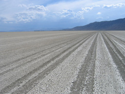 |
This set of tracks on the playa is actually in the same place as the maps indicate one branch of the California Trail. There was one on each side of the lake bed. Try this with a pair of oxen (if they're still alive) and a wagon.
After taking some photos and getting off the lake bed I went back south on the west side of Smoke Creek again, thinking it would be cool to be on the sunny side of this thunderstorm, if that was possible. Turns out it was, and I got some nice shots (I hope) that are similar to this:
 |
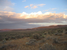 |
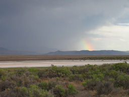
The clouds in the latter image were lit up much more as the sun went down. It was quite nice. This next little rainbow fragment was taken on the drive south. It's raining hard in the left half of the picture, and there was a lot of lightning. I saw smoke from a lightning started fire, but either the rain put it out or it disappeared into the gloom.
 |
Nothing really special this day, but it was a nice "visual warm up", and the storm was cool. I hope I see more and can photograph them.